The Trip
Montana. August 2014. We flew into Bozeman without a fully formed plan and left a few days later having learned more about our limits, and our appetites, than we bargained for. The Beaten Path cuts through the Absaroka-Beartooth Wilderness from the Clarks Fork trailhead in the southwest to East Rosebud Lake in the northeast: 26 miles of high alpine lakes, open tundra, rushing creek crossings, and some of the most dramatic canyon scenery in the northern Rockies. We had no idea what we were getting into, and that was mostly the point.
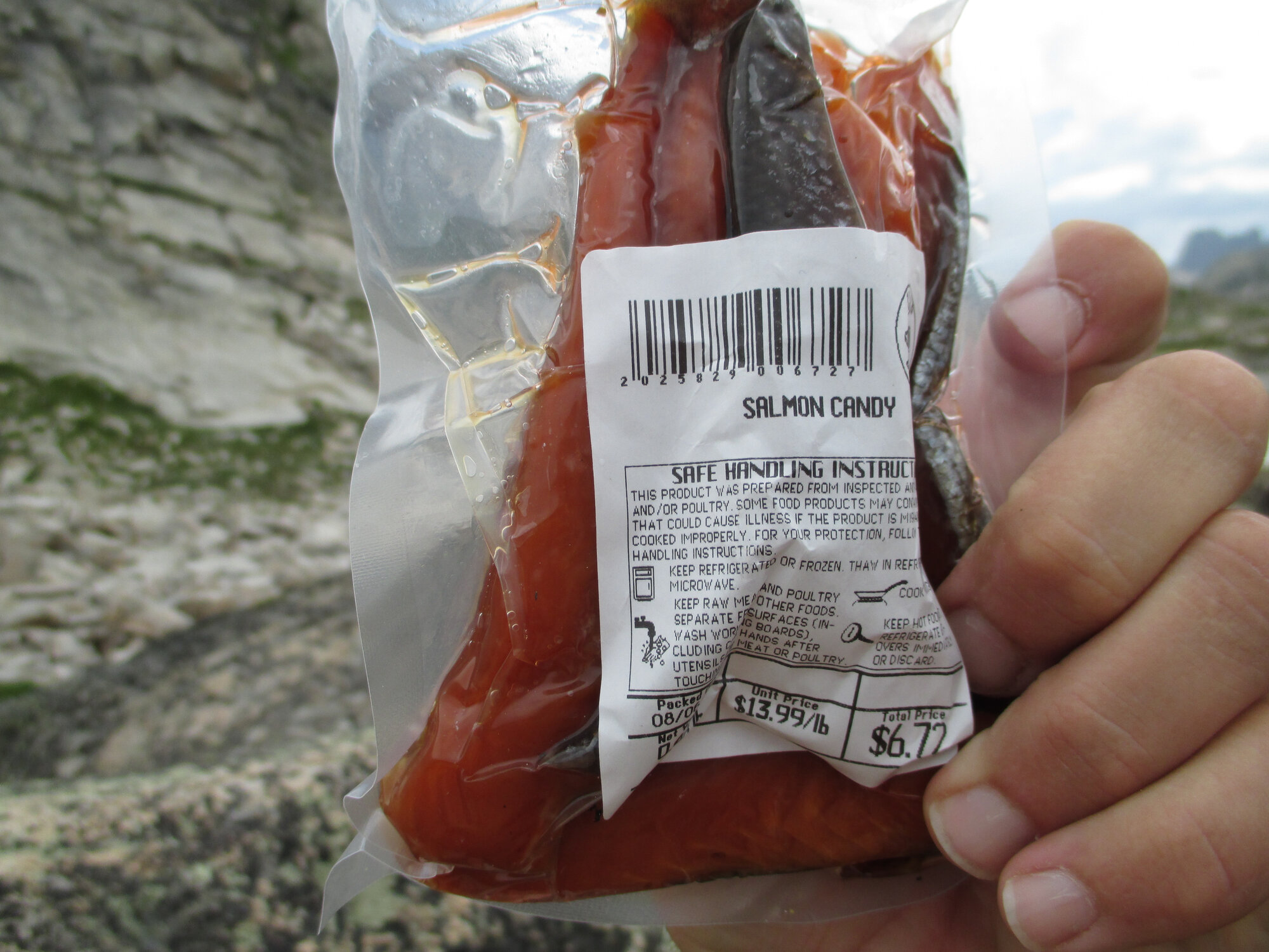
The trip started in Bozeman with a gear stop at REI, provisions at the grocery store and a swing through the downtown co-op for even more food. That's where we found the salmon candy: a glazed, cured salmon product sitting in the cooler that looked like the greatest backcountry snack ever conceived. It was, in fact, amazing. It was also, in hindsight, perhaps the most aromatic thing you could carry into grizzly country. These lessons are earned, not taught. From Bozeman we drove south toward Red Lodge with a lunch stop in Livingston at Mark's In & Out – no-frills, completely unpretentious, and genuinely one of the best burger-and-malt combinations you'll encounter anywhere. If you're passing through, stop.
"We had sixty-pound packs, seven pounds of summer sausage, and absolutely no idea what we were getting into. That was the whole point."
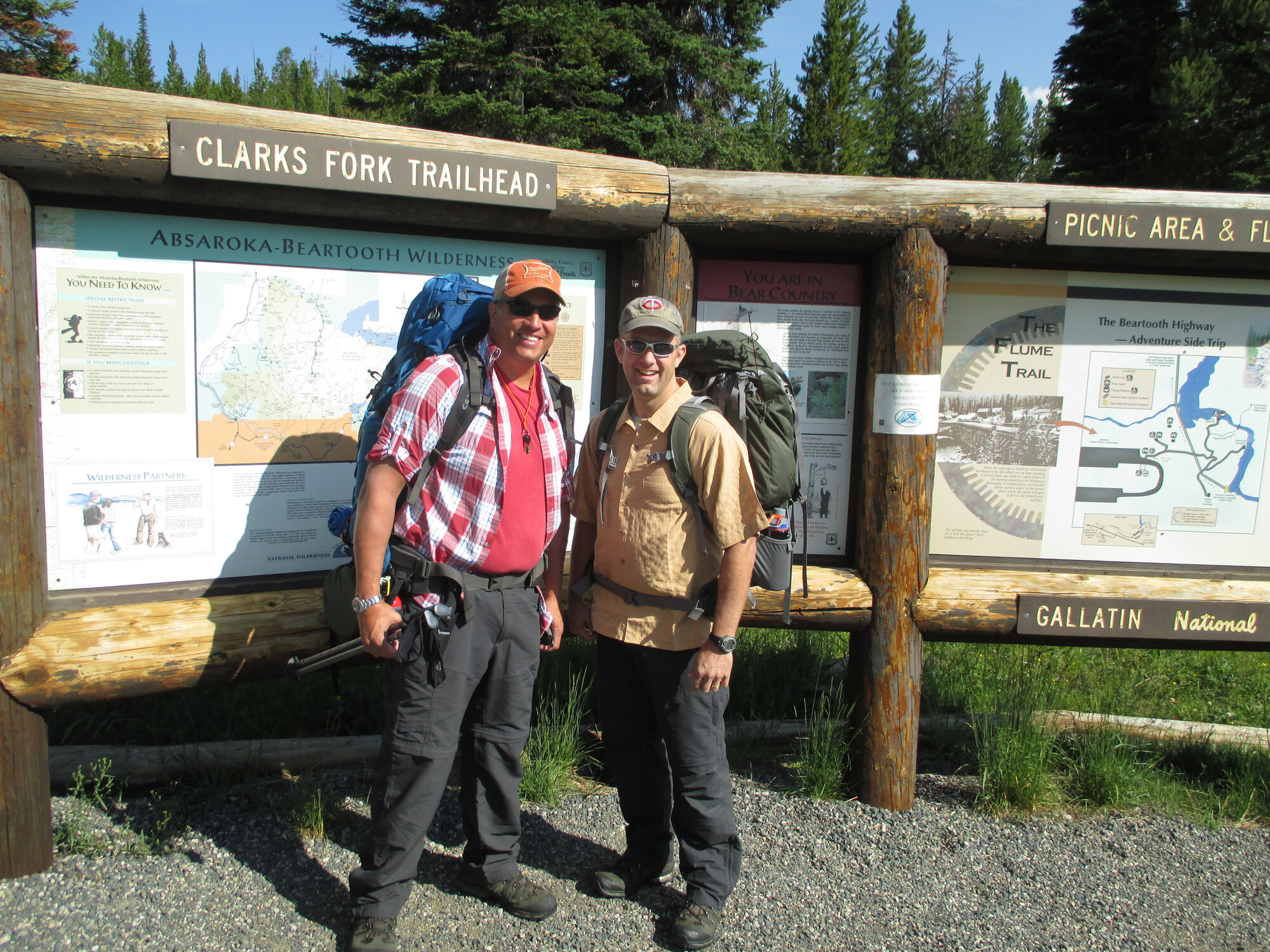
Red Lodge is exactly what a small Montana mountain town should be: a main street of bars, restaurants and outfitters, the Beartooth Highway climbing dramatically out of town toward the Wyoming border, and a laid-back pace that makes it easy to linger. We stayed at the Red Lodge Inn, then owned by a Minnesota couple whose version of hospitality included cold beers waiting in the cooler by the front door. That's the kind of thing you remember. That evening we walked down to the Sylvan Peak Mountain Shop, picked up a trail map, and got some pointed advice about what we were actually getting ourselves into. Their recommendation was unambiguous: run it south to north, Clarks Fork to East Rosebud.
Which immediately created a logistics problem. One rental car. Two trailheads. Three-plus hours of driving between them, over the Beartooth Pass. Fortunately, the woman at the Inn's front desk had an entrepreneurial streak and for $150, she'd drive us over the pass to the trailhead and leave our car at East Rosebud for pickup at the finish. Given the distance, it was a genuine bargain, and we said yes without hesitation. The next morning, she delivered us to the trailhead around 10 or 11 a.m., waved us off, and just like that, we were on our own.
We were, as first-timers tend to be, significantly overpacked. North of sixty pounds each, including – and this bears documenting – seven pounds of summer sausage. I still wonder what we were thinking. The trail eases you in, with gentle climbs past Kersey and Russel Lakes, following the Russel Creek drainage through the trees before the terrain starts to assert itself. We made good time, calling out "hey bear" at regular intervals, staying cheerful and vocal as grizzly country demands. The trail steepens after Russell Lake, switchbacks cutting upward through granite before Ouzel Lake comes into view beneath sheer cliffs that frame it like something from an Ansel Adams photo. We forded the cascades of Russell Creek and, in the early evening, found a quiet unnamed lake on the far side that felt like it had been set aside just for us. Nine miles, roughly 1,800 feet of climbing, sixty-pound packs. We cooked freeze-dried chili mac, called it a hearty dinner, and were asleep before dark.
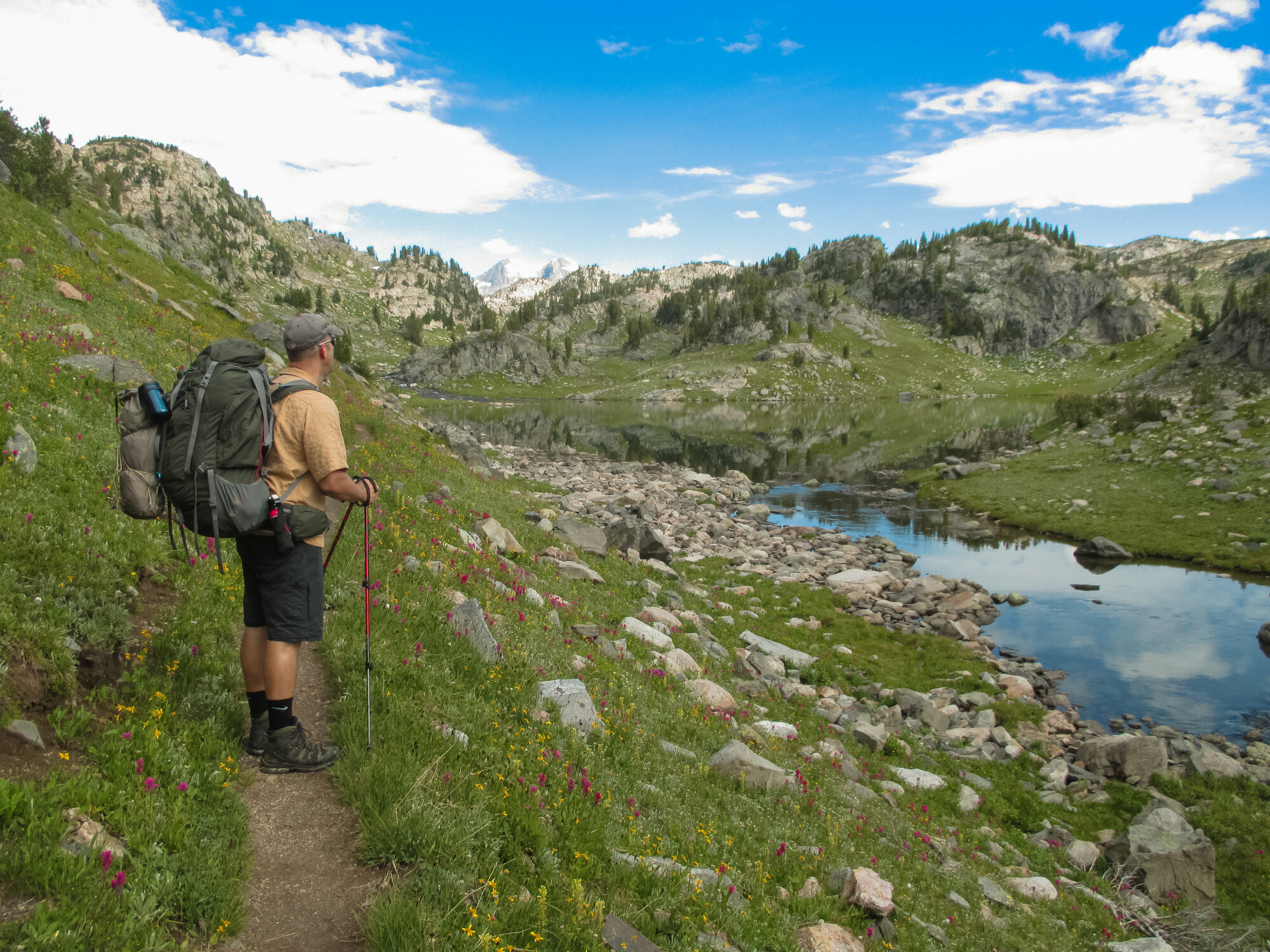
Day two started with a steep climb and packs that were no lighter than the day before. The trail ascends above tree line quickly, crossing a series of alpine lakes ringed with lupine and summer wildflowers; vivid purples, magentas and yellows against massive gray granite and the big sky Montana is known for. Then, despite being mid-August, snowfields. Actual snowfields. The stubborn remnants of a winter releases its grip slowly at this elevation. We crossed them without incident and climbed steadily toward Fossil Lake at approximately 10,200 feet, the high point of the route. We stopped there for lunch as clouds thickened overhead and a light rain began to fall. That's where the salmon candy made its backcountry debut. It was excellent; genuinely. It also left a certain presence on the hands. In grizzly country. We ate it anyway, glancing at the granite peaks disappearing into the mist, amused and questioning our decisions.
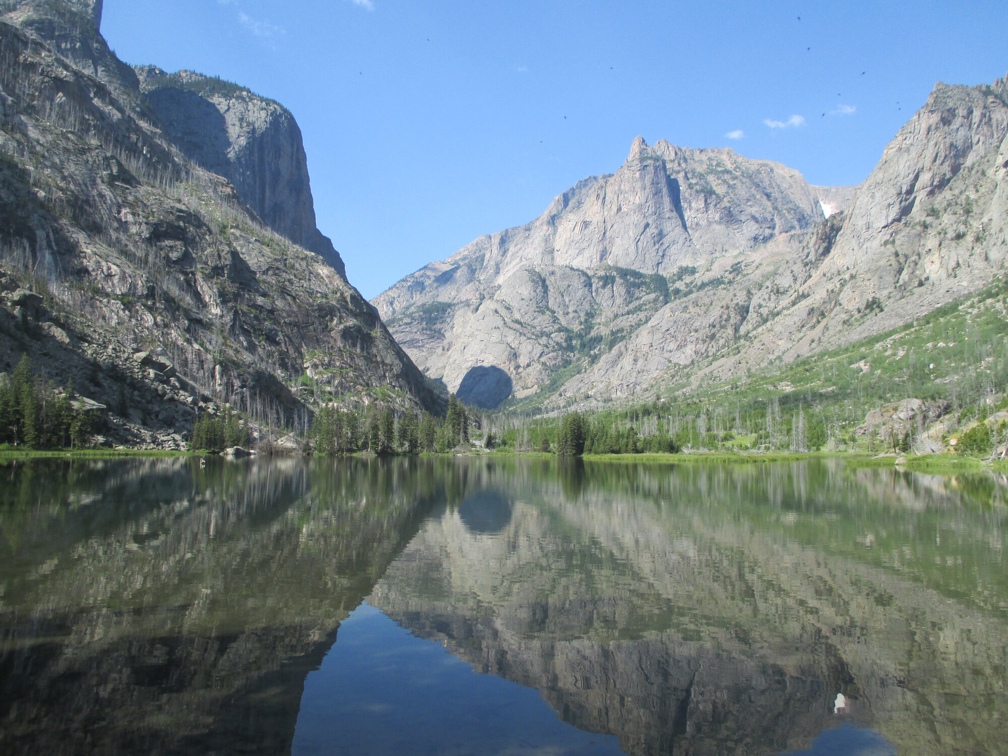
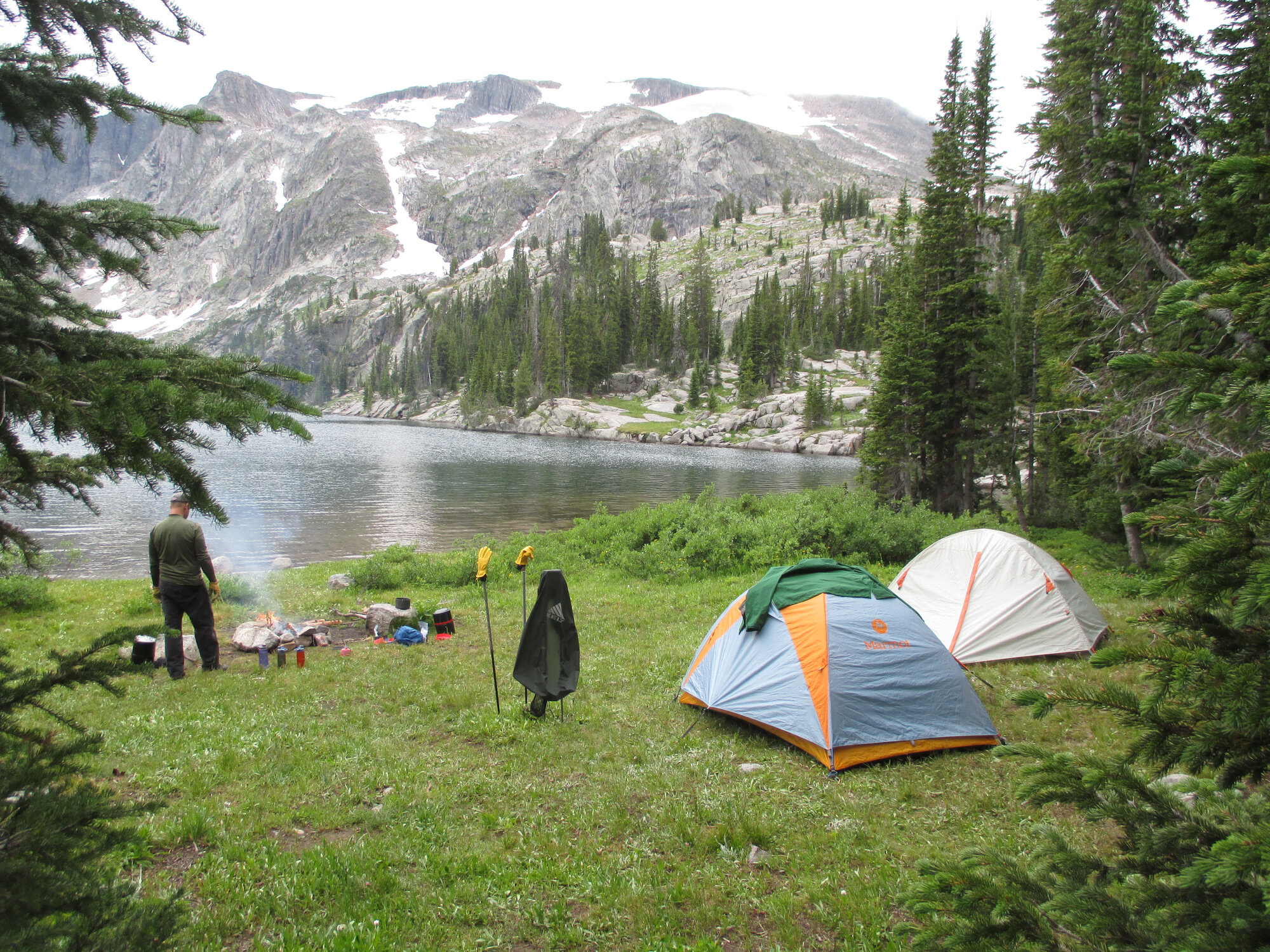
From Fossil Lake the trail tips downhhill toward the east drainage, but "downhill" is a relative term in the Beartooths. Camp that night was at Dewey Lake, where we had our first real encounter with other humans on the trip. The lake draws a small crowd for good reason. Several camps were already spread around the shore, likely drawn by what looked like serious fishing and impeccable views. The view from our site might as well be pulled from a magazine cover: Mount Dewey and Summit Mountain rising above the water at over 11,000 feet, their peaks reflected in the calm blue surface of the lake. We tried our hand at fishing but came up empty. Freeze-dried camp food for dinner again. Light rain moved in as evening arrived and we settled into the tents without complaint.
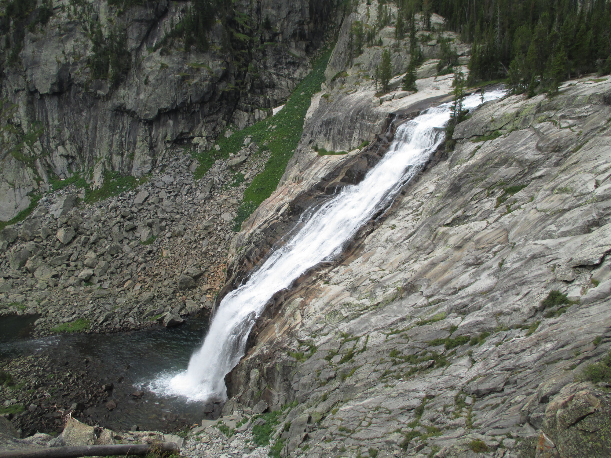
The third day along East Rosebud Creek is the star of the show. The drainage descends through a string of countless cascades and lakes – Twin Outlets with its impossibly clear water, Duggan Lake, Lake of the Falls – all connected by rushing water, cascades and steep falls that turn the miles into something closer to a highlight reel. Impasse Falls is the showpiece: a long, dramatic plunge down open slickrock that you hear long before you see it. Somewhere in the drainage we were flagged down by a forest ranger with a pointed interest in how thoroughly we were burying our personal business in the backcountry. Leave no trace principles are in full force here, as they should be. She had follow-up questions. We answered them earnestly and moved on. We scouted a camp at Rainbow Lake, but it didn't feel right, so we pressed on to Rimrock. We were glad we did. The site we found was as good as any on the trip: close to the water; maybe a little closer than permitted, but, the narrow canyon walls afford no further tent pads. Tree-lined peaks and cool blue water were visible from the tent doors and we enjoyed the kind of quiet that's hard to find anywhere else. We built a fire, cooked our last camp meal, and let the evening take its time.
The final push from Rimrock to East Rosebud drops through steep canyon country, walls of granite closing in on both sides as the creek picks up speed below. One last swim at Elk Lake; cold, clear, and refreshing. Then the trailhead, the rental car waiting exactly where it was supposed to be, and a certain mild disbelief that it was actually over. Twenty-six miles. Three nights out. We were hungry in the way that only happens after a few days of real effort.
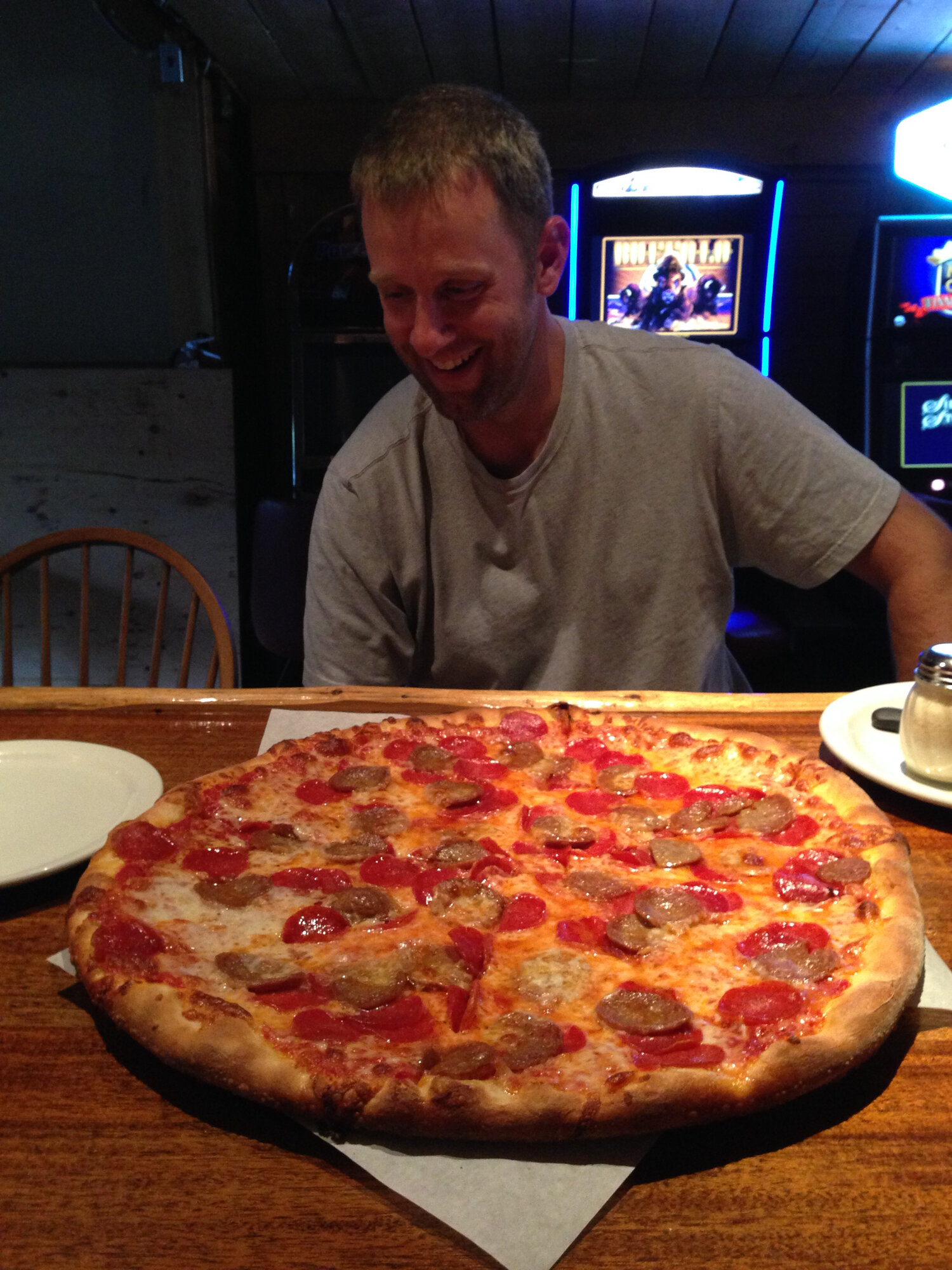
We drove to the Grizzly Bar in Roscoe for cold beers and a burger that was, by any reasonable measure, improbably large. We drove back through Red Lodge, over the Beartooth Pass and on to Cooke City, one of my favorite mountain towns anywhere. We devoured pizza at the Miners Saloon, still hungry enough that "improbably large" was again barely adequate. Of the seven pounds of summer sausage we'd carried the full length of the Absaroka-Beartooth Wilderness, we ate one. One log. The other six made the return trip to civilization.
The Beaten Path has a way of teaching you things you didn't know you needed to learn. You find out what you're capable of when the weight is real and the miles are hard. You learn that the best campsites sometimes take that extra mile. And you learn – if you're paying attention – that there is absolutely never, under any circumstances, a need for seven pounds of summer sausage. Pack light. Get off the grid. The rest takes care of itself.